426-450 Streatham High Road
Introduction
The photograph on this page of 426-450 Streatham High Road by Stephen Richards as part of the Geograph project.
The Geograph project started in 2005 with the aim of publishing, organising and preserving representative images for every square kilometre of Great Britain, Ireland and the Isle of Man.

There are currently over 7.5m images from over 14,400 individuals and you can help contribute to the project by visiting https://www.geograph.org.uk
426-450 Streatham High Road
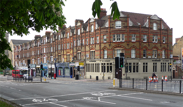
Image: © Stephen Richards Taken: Unknown
The rhythm set further up the High Road (here for example: Image]) is taken up again by this little group running south from the junction with Greyhound Lane, before vanishing completely on the way to Norbury. Built in 1890 with the usual tall, narrow frontages with shaped gables and fancy brickwork, albeit of a slightly lower quality than elsewhere on the High Road. A cast iron and glass canopy originally extended the length of the parade. It is within the Streatham Common Conservation Area. The curved building on the end used to be a bank and is now a bar.
Images are licensed for reuse under creativecommons.org/licenses/by-sa/2.0
Image Location
Latitude
51.421182
Longitude
-0.12915