Path to Dalmoak
Introduction
The photograph on this page of Path to Dalmoak by Lairich Rig as part of the Geograph project.
The Geograph project started in 2005 with the aim of publishing, organising and preserving representative images for every square kilometre of Great Britain, Ireland and the Isle of Man.

There are currently over 7.5m images from over 14,400 individuals and you can help contribute to the project by visiting https://www.geograph.org.uk
Path to Dalmoak
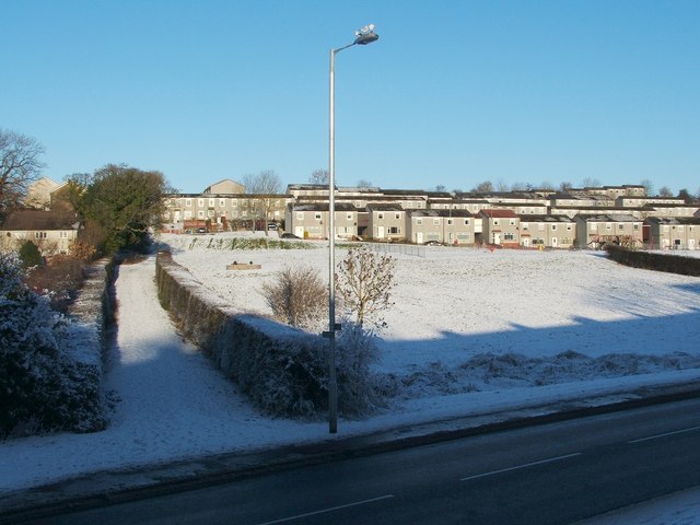
Image: © Lairich Rig Taken: 24 Dec 2010
Cardross Road is visible in the foreground. On its far side, on the left, the route that is confined between two hedges is the first part of a path to Dalmoak. That path is signposted (on the lamp post) as "Path to Dalmoak via Castlehill ¾ mile". The former site of Hawthornhill Farm is visible in this picture: to the left of the lamp post, and to the right of the hedge-lined path, is a large drain cover; directly behind that is a green embankment with less snow cover than its surroundings. The buildings of Hawthornhill stood on the flat area at the top of that embankment, centred on Image: Image
Images are licensed for reuse under creativecommons.org/licenses/by-sa/2.0
Image Location
Latitude
55.949339
Longitude
-4.601698