The Greyhound, Greyhound Lane
Introduction
The photograph on this page of The Greyhound, Greyhound Lane by Stephen Richards as part of the Geograph project.
The Geograph project started in 2005 with the aim of publishing, organising and preserving representative images for every square kilometre of Great Britain, Ireland and the Isle of Man.

There are currently over 7.5m images from over 14,400 individuals and you can help contribute to the project by visiting https://www.geograph.org.uk
The Greyhound, Greyhound Lane
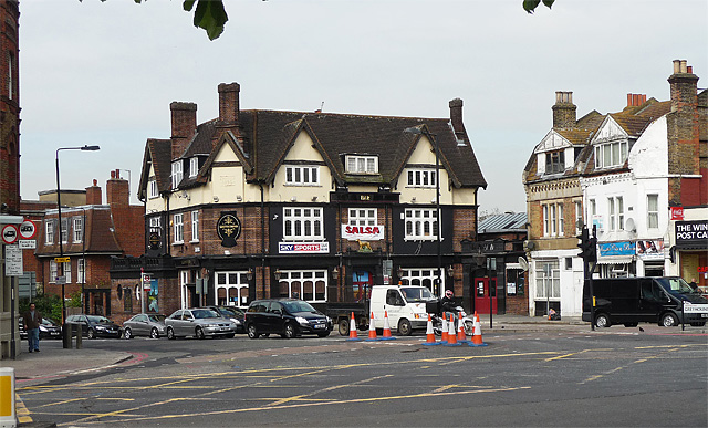
Image: © Stephen Richards Taken: Unknown
A large, typical roadside pub of the inter-war years, having been rebuilt in the 1930s. Due to its location on the main London-to-Brighton road, there has been a coaching inn on this site since the early C18th. Salsa lessons, however, are a more recent innovation. It is within the Streatham Common Conservation Area.
Images are licensed for reuse under creativecommons.org/licenses/by-sa/2.0
Image Location
Latitude
51.42191
Longitude
-0.129696