The former Cross Keys, Crowle
Introduction
The photograph on this page of The former Cross Keys, Crowle by Jonathan Thacker as part of the Geograph project.
The Geograph project started in 2005 with the aim of publishing, organising and preserving representative images for every square kilometre of Great Britain, Ireland and the Isle of Man.

There are currently over 7.5m images from over 14,400 individuals and you can help contribute to the project by visiting https://www.geograph.org.uk
The former Cross Keys, Crowle
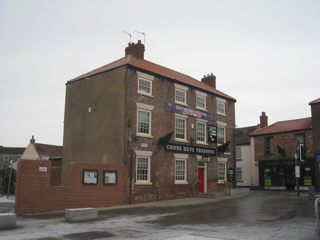
Image: © Jonathan Thacker Taken: 26 Dec 2010
The former Cross Keys is now converted to offices and training facilities. The piece of incomplete walling to the left is a screen erected to disguise a few parking spaces in the next street. Is this the first example of a council erecting what looks like a half demolished building for this purpose ? It looks terrible. Crowle has enough derelict spaces as it is. This makes it look as if North Lincolnshire Council has decided it is Crowle's best selling point.
Images are licensed for reuse under creativecommons.org/licenses/by-sa/2.0
Image Location


Leaflet Map data © OpenStreetMap
Latitude
53.606072
Longitude
-0.833679