Hazardous pavement, Malpas Road, Newport
Introduction
The photograph on this page of Hazardous pavement, Malpas Road, Newport by Jaggery as part of the Geograph project.
The Geograph project started in 2005 with the aim of publishing, organising and preserving representative images for every square kilometre of Great Britain, Ireland and the Isle of Man.

There are currently over 7.5m images from over 14,400 individuals and you can help contribute to the project by visiting https://www.geograph.org.uk
Hazardous pavement, Malpas Road, Newport
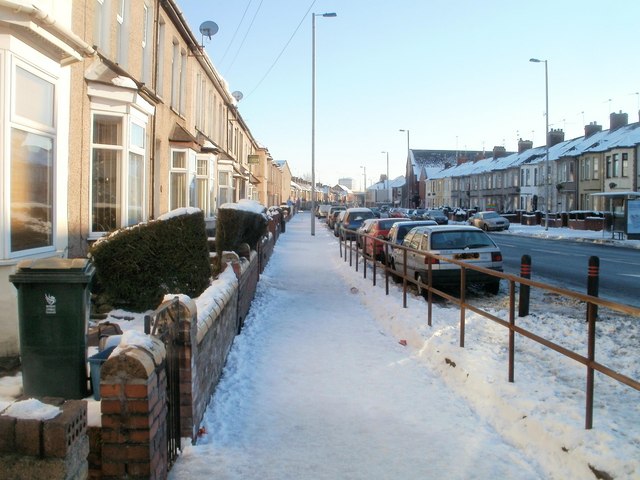
Image: © Jaggery Taken: 25 Dec 2010
Early afternoon, Christmas Day 2010. A moderate snowfall five days earlier has partially melted then refrozen, giving a hazardous mixture of ice and compacted snow. Fortunately there are railings for support if needed...
Images are licensed for reuse under creativecommons.org/licenses/by-sa/2.0
Image Location
Latitude
51.598262
Longitude
-3.001907