The Old Stag's Head near Penn Common, Staffordshire
Introduction
The photograph on this page of The Old Stag's Head near Penn Common, Staffordshire by Roger D Kidd as part of the Geograph project.
The Geograph project started in 2005 with the aim of publishing, organising and preserving representative images for every square kilometre of Great Britain, Ireland and the Isle of Man.

There are currently over 7.5m images from over 14,400 individuals and you can help contribute to the project by visiting https://www.geograph.org.uk
The Old Stag's Head near Penn Common, Staffordshire
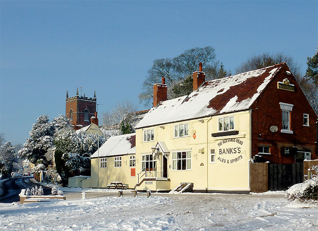
Image: © Roger D Kidd Taken: 19 Dec 2010
This old ale house is at the junction of Pennwood Lane with Sedgley Road (turn left by the horse trough). The tower of St Bartholomew's Church can be seen in the background. Following two weeks of very cold conditions, about 12-15cm of snow had fallen the previous day, and temperatures had been down as low as -12°C overnight, staying below freezing during the day. Fog and low cloud had quite suddenly lifted or dispersed about half an hour earlier but the temperature was still well below zero at the time of the image, 12:49 GMT. Note: a week later, the temperature had still only briefly risen just above freezing, causing many icicles to form on buildings, and nearly all this snow remains. During the very early hours of 27 December icicles began to fall off buildings, and quite a rapid thaw followed.
Images are licensed for reuse under creativecommons.org/licenses/by-sa/2.0
Image Location
Latitude
52.554727
Longitude
-2.156091