Old houses, Severn Side
Introduction
The photograph on this page of Old houses, Severn Side by P L Chadwick as part of the Geograph project.
The Geograph project started in 2005 with the aim of publishing, organising and preserving representative images for every square kilometre of Great Britain, Ireland and the Isle of Man.

There are currently over 7.5m images from over 14,400 individuals and you can help contribute to the project by visiting https://www.geograph.org.uk
Old houses, Severn Side
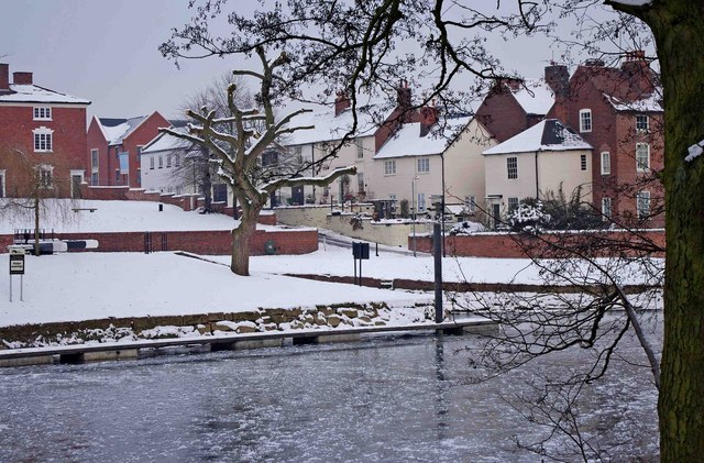
Image: © P L Chadwick Taken: 26 Dec 2010
The old houses, seen here from across a frozen River Severn, are thought to date from around the late 18th century. The building on the immediate left, a corner of which can be seen here, is the well known Tontine.
Images are licensed for reuse under creativecommons.org/licenses/by-sa/2.0
Image Location
Latitude
52.336573
Longitude
-2.279101