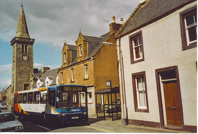
Strathmiglo High Street
Introduction
The photograph on this page of Strathmiglo High Street by Colin Smith as part of the Geograph project.
The Geograph project started in 2005 with the aim of publishing, organising and preserving representative images for every square kilometre of Great Britain, Ireland and the Isle of Man.
There are currently over 7.5m images from over 14,400 individuals and you can help contribute to the project by visiting https://www.geograph.org.uk

Image: © Colin Smith Taken: 23 Jul 2006
The village is locally known as "Strath" and it sits on the River Miglo (the name given to the upper River Eden). The houses are typically Scottish with dormer windows, crow-stepped gables and contrasting coloured quoins around doors & windows. The Town Hall Steeple dates back to 1734 and its ground floor housed the village cells. The Town Hall was on the first floor, entered by the forestair. The Stagecoach bus is on its way from Perth to the new town of Glenrothes.

