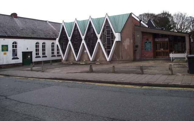
Trinity Methodist Church
Introduction
The photograph on this page of Trinity Methodist Church by Jonathan Kington as part of the Geograph project.
The Geograph project started in 2005 with the aim of publishing, organising and preserving representative images for every square kilometre of Great Britain, Ireland and the Isle of Man.
There are currently over 7.5m images from over 14,400 individuals and you can help contribute to the project by visiting https://www.geograph.org.uk

Image: © Jonathan Kington Taken: 15 Dec 2010
The first chapel on this site was built in 1766 and had seating for a congregation of 400 people, the next two hundred years saw a number of different buildings- all used as chapels. When, in the mid 1960's, remedial work uncovered some potentially dangerous faults the last building was condemned. The present building was consecrated in 1968 and brought together the three congregations of Brook Street, Queen Street and Wagg Street, forming the Trinity of its name. The white building to the left is the Church Hall.

