All Saints' Church and Vulcan
Introduction
The photograph on this page of All Saints' Church and Vulcan by Peter Clare as part of the Geograph project.
The Geograph project started in 2005 with the aim of publishing, organising and preserving representative images for every square kilometre of Great Britain, Ireland and the Isle of Man.

There are currently over 7.5m images from over 14,400 individuals and you can help contribute to the project by visiting https://www.geograph.org.uk
All Saints' Church and Vulcan
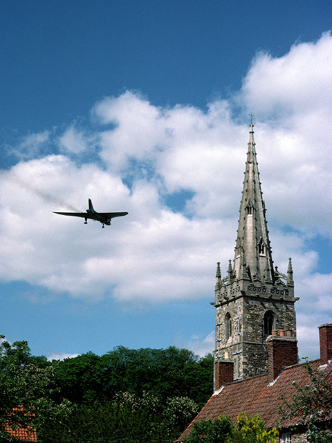
Image: © Peter Clare Taken: Unknown
A Vulcan bomber flies past the church on approach to RAF Waddington. Once a daily sight low in the skies over Coleby. Note the red aircraft warning lights at the top of the church spire.
Images are licensed for reuse under creativecommons.org/licenses/by-sa/2.0
Image Location
Latitude
53.133832
Longitude
-0.544262