Haughton Strother Farmhouse
Introduction
The photograph on this page of Haughton Strother Farmhouse by Les Hull as part of the Geograph project.
The Geograph project started in 2005 with the aim of publishing, organising and preserving representative images for every square kilometre of Great Britain, Ireland and the Isle of Man.

There are currently over 7.5m images from over 14,400 individuals and you can help contribute to the project by visiting https://www.geograph.org.uk
Haughton Strother Farmhouse
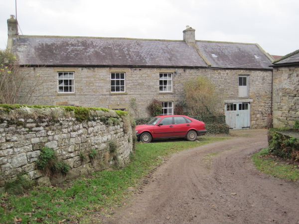
Image: © Les Hull Taken: 17 Nov 2010
Haughton Strother Farmhouse is a typical Northumbrian farmstead group of the 18th century. There is a farmhouse of two storeys arranged around a central doorway; the outbuilding - unspecific to a single purpose - is attached. There has been only limited embellishments of the construction materials. This is a Grade II Listed Building protected by law. http://www.keystothepast.info/durhamcc/K2P.nsf/K2PDetail?readform&PRN=N21500
Images are licensed for reuse under creativecommons.org/licenses/by-sa/2.0
Image Location
Latitude
55.058572
Longitude
-2.164661