Farmland near Seighford
Introduction
The photograph on this page of Farmland near Seighford by Simon Huguet as part of the Geograph project.
The Geograph project started in 2005 with the aim of publishing, organising and preserving representative images for every square kilometre of Great Britain, Ireland and the Isle of Man.

There are currently over 7.5m images from over 14,400 individuals and you can help contribute to the project by visiting https://www.geograph.org.uk
Farmland near Seighford
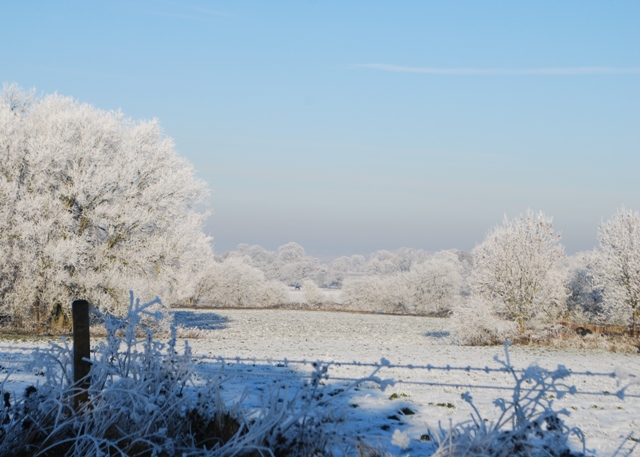
Image: © Simon Huguet Taken: 7 Dec 2010
Looking across snowy fields with the Long Covert on the left. Somewhere near here Grange Farm once stood before it was demolished to make way for the new WW2 airfield. The little brick structure in the trees is the remains of an airfield building later converted to a silo for winter stock feed. See also image Image
Images are licensed for reuse under creativecommons.org/licenses/by-sa/2.0
Image Location
Latitude
52.827502
Longitude
-2.191262