Railway bridge, Darley Green: 1
Introduction
The photograph on this page of Railway bridge, Darley Green: 1 by Robin Stott as part of the Geograph project.
The Geograph project started in 2005 with the aim of publishing, organising and preserving representative images for every square kilometre of Great Britain, Ireland and the Isle of Man.

There are currently over 7.5m images from over 14,400 individuals and you can help contribute to the project by visiting https://www.geograph.org.uk
Railway bridge, Darley Green: 1
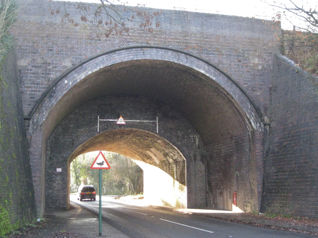
Image: © Robin Stott Taken: 5 Dec 2010
This massive bridge takes the Snow Hill line over Darley Green Road southeast of Dorridge. An excellent Wikipedia article on Dorridge says that the line was originally four-track between Birmingham and Lapworth but had been reduced to two by the mid-1960s. The form of this bridge suggests that an original two lines were widened to four as commuter traffic developed in mid-Warwickshire from growing communities such as Dorridge. This, the north side, is in blue brick while the lower-height southern span is of orange brick. Postbox B95 99 is set into the northwest abutment (there is a terrace of houses out of shot, right). B95 is odd because all the postcodes hereabouts are B93. Road sign appears to warn of ducks. There are brooks nearby.
Images are licensed for reuse under creativecommons.org/licenses/by-sa/2.0
Image Location
Latitude
52.364667
Longitude
-1.740018