Wheelwrights Court
Introduction
The photograph on this page of Wheelwrights Court by Ian Capper as part of the Geograph project.
The Geograph project started in 2005 with the aim of publishing, organising and preserving representative images for every square kilometre of Great Britain, Ireland and the Isle of Man.

There are currently over 7.5m images from over 14,400 individuals and you can help contribute to the project by visiting https://www.geograph.org.uk
Wheelwrights Court
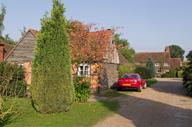
Image: © Ian Capper Taken: 10 Oct 2010
A short close off Horley Row, which gives access to some of the cottages shown on older maps separated from the road (originally a track) by an area of open ground, being the northern edge of what was Horley Common. They are now separated from (and largely hidden from sight from) the road by more recent buildings. Lydford, in the background, a 17th century grade II listed cottage, is one example of these - for listing particulars see www.historicengland.org.uk/listing/the-list/list-entry/1378038. The barn on the left was originally a wheelwright's shop (hence the name of the close). It later became the building yard of local builders, Andersons, who developed much of the area south of Horley Row. The barn has since been converted into a house. Dating originally from around 1700, it too is grade II listed - for listing particulars see www.historicengland.org.uk/listing/the-list/list-entry/1378024.
Images are licensed for reuse under creativecommons.org/licenses/by-sa/2.0
Image Location
Latitude
51.180628
Longitude
-0.169181