Dorridge railway station
Introduction
The photograph on this page of Dorridge railway station by Robin Stott as part of the Geograph project.
The Geograph project started in 2005 with the aim of publishing, organising and preserving representative images for every square kilometre of Great Britain, Ireland and the Isle of Man.

There are currently over 7.5m images from over 14,400 individuals and you can help contribute to the project by visiting https://www.geograph.org.uk
Dorridge railway station
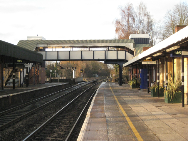
Image: © Robin Stott Taken: 5 Dec 2010
Looking northwest, towards Birmingham. Compare Image The light snowfall of recent days has melted but there are still frosts, which the Phormiums are surviving. The platforms were noisily crunchy underfoot with hard fine-grained salt. Dorridge began here in 1852 when Brunel built this station to serve the wealthy families of Knowle, ancient village to the northeast Image Now Dorridge is a place in its own right and strongly suburban in character.
Images are licensed for reuse under creativecommons.org/licenses/by-sa/2.0
Image Location
Latitude
52.371888
Longitude
-1.753195