Clarendon House
Introduction
The photograph on this page of Clarendon House by David Anstiss as part of the Geograph project.
The Geograph project started in 2005 with the aim of publishing, organising and preserving representative images for every square kilometre of Great Britain, Ireland and the Isle of Man.

There are currently over 7.5m images from over 14,400 individuals and you can help contribute to the project by visiting https://www.geograph.org.uk
Clarendon House
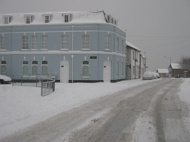
Image: © David Anstiss Taken: 3 Dec 2010
On the junction of Church Street (on the right) and Church Path (on the left). This used to be a pub. See Image Church Path is also part of the Saxon Shore Way (long distance path), heading from the Strand left to Chatham. Due to the snow and ice, hardly any traffic is using the road.
Images are licensed for reuse under creativecommons.org/licenses/by-sa/2.0
Image Location


Leaflet Map data © OpenStreetMap
Latitude
51.390525
Longitude
0.559989