Tankersley Old Hall and Farm
Introduction
The photograph on this page of Tankersley Old Hall and Farm by Jonathan Clitheroe as part of the Geograph project.
The Geograph project started in 2005 with the aim of publishing, organising and preserving representative images for every square kilometre of Great Britain, Ireland and the Isle of Man.

There are currently over 7.5m images from over 14,400 individuals and you can help contribute to the project by visiting https://www.geograph.org.uk
Tankersley Old Hall and Farm
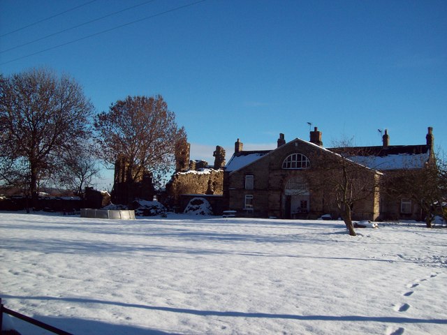
Image: © Jonathan Clitheroe Taken: 5 Dec 2010
Ruins of the late 16th century Tankersley Old Hall, pictured here alongside Old Hall Farm. Surveys have shown that the Old Hall was very likely to have been built on the site of an earlier medieval hunting lodge.
Images are licensed for reuse under creativecommons.org/licenses/by-sa/2.0
Image Location
Latitude
53.485528
Longitude
-1.464824