Forest Fields skyline
Introduction
The photograph on this page of Forest Fields skyline by John Sutton as part of the Geograph project.
The Geograph project started in 2005 with the aim of publishing, organising and preserving representative images for every square kilometre of Great Britain, Ireland and the Isle of Man.

There are currently over 7.5m images from over 14,400 individuals and you can help contribute to the project by visiting https://www.geograph.org.uk
Forest Fields skyline
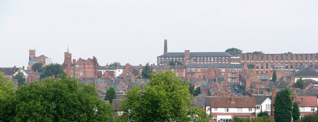
Image: © John Sutton Taken: 9 Sep 2010
This zoom shot from The Forest shows (from left) Mount Street Mill, the spire and gables of the former High Pavement (and later Forest Fields) Grammar School, then the former textile mills on Beech Avenue, with the three-storey terraces of Gladstone Street in front of them.
Images are licensed for reuse under creativecommons.org/licenses/by-sa/2.0
Image Location
Latitude
52.970805
Longitude
-1.165347