The Black Horse
Introduction
The photograph on this page of The Black Horse by Ian Capper as part of the Geograph project.
The Geograph project started in 2005 with the aim of publishing, organising and preserving representative images for every square kilometre of Great Britain, Ireland and the Isle of Man.

There are currently over 7.5m images from over 14,400 individuals and you can help contribute to the project by visiting https://www.geograph.org.uk
The Black Horse
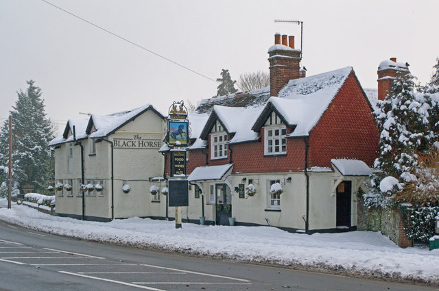
Image: © Ian Capper Taken: 3 Dec 2010
Or is it the White Horse? The Black Horse dates from around 1760, built by a Mr John Fist. Seen here after three days of heavy snowfall.
Images are licensed for reuse under creativecommons.org/licenses/by-sa/2.0
Image Location
Latitude
51.240341
Longitude
-0.221123