Marks Gate windmill in 1920
Introduction
The photograph on this page of Marks Gate windmill in 1920 by George W Baker as part of the Geograph project.
The Geograph project started in 2005 with the aim of publishing, organising and preserving representative images for every square kilometre of Great Britain, Ireland and the Isle of Man.

There are currently over 7.5m images from over 14,400 individuals and you can help contribute to the project by visiting https://www.geograph.org.uk
Marks Gate windmill in 1920
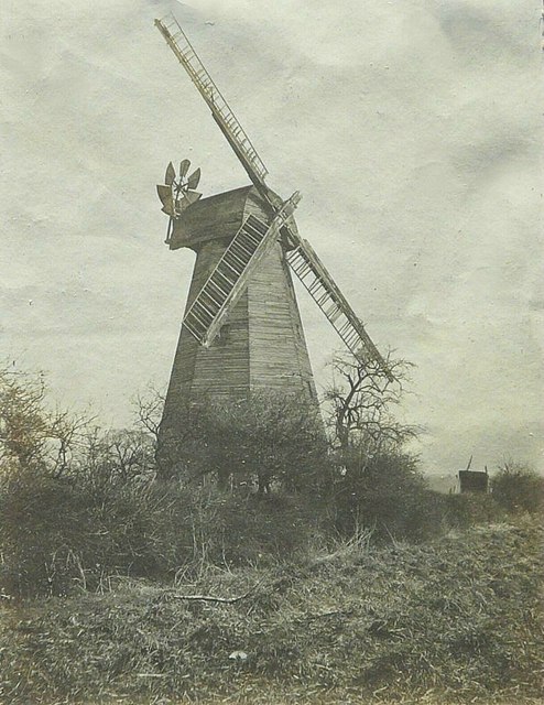
Image: © George W Baker Taken: Unknown
The original image resides in an album that was my paternal grandfather's: George W Baker and therefore he might have photographed the mill in its last days. The discussion I added to http://www.geograph.org.uk/photo/1655097 states that the structure of the mill was considered unsafe soon after 1921 when all but the brick base was demolished.
Images are licensed for reuse under creativecommons.org/licenses/by-sa/2.0
Image Location
Latitude
51.58945
Longitude
0.143241