Forth Banks
Introduction
The photograph on this page of Forth Banks by Andrew Curtis as part of the Geograph project.
The Geograph project started in 2005 with the aim of publishing, organising and preserving representative images for every square kilometre of Great Britain, Ireland and the Isle of Man.

There are currently over 7.5m images from over 14,400 individuals and you can help contribute to the project by visiting https://www.geograph.org.uk
Forth Banks
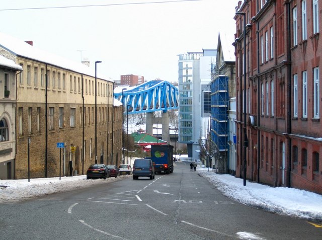
Image: © Andrew Curtis Taken: 30 Nov 2010
The name 'Forth' is derived from 'Frith', meaning a pasture or shaded place. This refers to an area just outside the Town Walls which was used for recreation in the mid-C16th. It was bounded to the west by the Skinner Burn and was the site of Newcastle's first hospital or Infirmary which opened in 1751 http://research.ncl.ac.uk/nsa/tl1.htm Although now completely underground, the Skinner Burn is still remembered by Skinnerburn Road which joins the bottom of Forth Banks on the right. There is an interesting photo on this site from 1978 showing the Metro Bridge being built over Forth Banks Image and a more recent one from further down the hill here Image There is a c1900 photo of Forth Banks here http://www.flickr.com/photos/newcastlelibraries/4081787082/
Images are licensed for reuse under creativecommons.org/licenses/by-sa/2.0
Image Location
Latitude
54.966154
Longitude
-1.617457