Smithford Way
Introduction
The photograph on this page of Smithford Way by E Gammie as part of the Geograph project.
The Geograph project started in 2005 with the aim of publishing, organising and preserving representative images for every square kilometre of Great Britain, Ireland and the Isle of Man.

There are currently over 7.5m images from over 14,400 individuals and you can help contribute to the project by visiting https://www.geograph.org.uk
Smithford Way
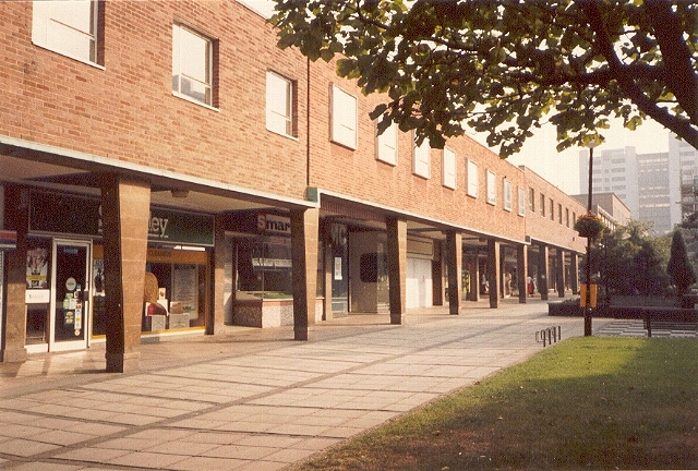
Image: © E Gammie Taken: Unknown
The east side of Smithford Way before it was demolished for the construction of the West Orchards shopping centre. This is much as it looked when built in the late 1950s, with several small shops in a two-storey arcade. To the right, in the distance, is the later Coventry Point tower block in Market Way. In the foreground are four small racks for cycle parking and, partially visible, an open air chess board laid out on the paving, the chess pieces for which were loaned out from a nearby sports shop. Taken on a Sunday predating the introduction of Sunday trading, hence the lack of people. Note also the lack of shuttering on the closed shops. In 2010: http://www.geograph.org.uk/photo/2184480
Images are licensed for reuse under creativecommons.org/licenses/by-sa/2.0
Image Location


Leaflet Map data © OpenStreetMap
Latitude
52.40944
Longitude
-1.512777