
Clayton Street West, Newcastle upon Tyne
Introduction
The photograph on this page of Clayton Street West, Newcastle upon Tyne by Andrew Curtis as part of the Geograph project.
The Geograph project started in 2005 with the aim of publishing, organising and preserving representative images for every square kilometre of Great Britain, Ireland and the Isle of Man.

There are currently over 7.5m images from over 14,400 individuals and you can help contribute to the project by visiting https://www.geograph.org.uk
Clayton Street West, Newcastle upon Tyne
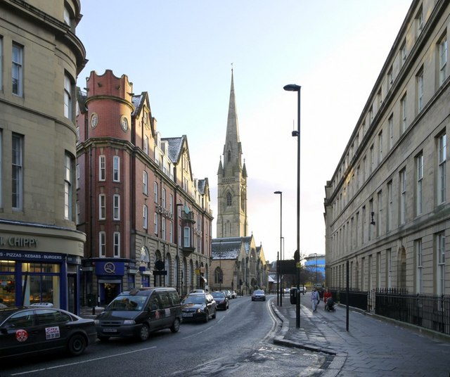
Image: © Andrew Curtis Taken: 31 Jan 2010
Clayton Street Chippy is on the left, before the opening to Pink Lane Image The lane takes its name from Pink Tower on the old town wall which stood in this location until demolished in 1852. Tyne and Wear HER (6502): Newcastle, Pink Lane http://www.twsitelines.info Further down the street is Clarendon House (formerly a temperance hotel built c1896 by Oliver & Leeson) and St Mary's Cathedral. At the end of the road the blue building of the International Centre for Life is visible Image On the right side of the street the properties form part of Richard Grainger's redevelopment of the town centre, although only the façades now remain.
Images are licensed for reuse under creativecommons.org/licenses/by-sa/2.0
Image Location

Latitude
54.969755
Longitude
-1.619454