Cooke Street, Belfast
Introduction
The photograph on this page of Cooke Street, Belfast by Albert Bridge as part of the Geograph project.
The Geograph project started in 2005 with the aim of publishing, organising and preserving representative images for every square kilometre of Great Britain, Ireland and the Isle of Man.

There are currently over 7.5m images from over 14,400 individuals and you can help contribute to the project by visiting https://www.geograph.org.uk
Cooke Street, Belfast
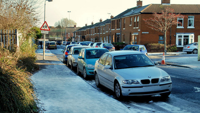
Image: © Albert Bridge Taken: 30 Nov 2010
Cooke Street was completed before 1880 and ran from the Ormeau Road towards the Lagan (background). Today’s Sraid Cooke/Cooke Street is the redeveloped version on the same line. Cooke Mews/Eachlann Cooke is on the right. This scene was standard throughout Belfast today. Just about any street, not on a main road and not receiving direct sunlight had a coating of treacherous ice which made walking next to impossible for many.
Images are licensed for reuse under creativecommons.org/licenses/by-sa/2.0
Image Location
Latitude
54.588122
Longitude
-5.922804