Stoneswood Mill, Bacup Road, Todmorden
Introduction
The photograph on this page of Stoneswood Mill, Bacup Road, Todmorden by Robert Wade as part of the Geograph project.
The Geograph project started in 2005 with the aim of publishing, organising and preserving representative images for every square kilometre of Great Britain, Ireland and the Isle of Man.

There are currently over 7.5m images from over 14,400 individuals and you can help contribute to the project by visiting https://www.geograph.org.uk
Stoneswood Mill, Bacup Road, Todmorden
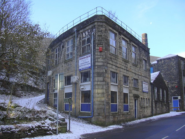
Image: © Robert Wade Taken: 27 Nov 2010
Stoneswood, or more properly, the Inchfield Pasture Cotton Mill, is one of the very early cotton carding and spinning mills. It is situated in the Dulesgate valley (Bacup Road), obtaining its power from the Dulesgate stream. The original mill would have been a small affair with a water wheel. The present mill consists of two adjacent but separate buildings. The higher of the two is the older, and would have replaced the original mill. The lower building was erected much later, about 1900. Both buildings are 3 storeys high. The space between the two is used for car parking and as a loading bay. Researched, recorded and referenced by Mrs Sheila Wade Hebden Bridge WEA Local History Group
Images are licensed for reuse under creativecommons.org/licenses/by-sa/2.0
Image Location
Latitude
53.705889
Longitude
-2.118728