
Building a dry stone wall, Dorset, 2009 (1)
Introduction
The photograph on this page of Building a dry stone wall, Dorset, 2009 (1) by Stefan Czapski as part of the Geograph project.
The Geograph project started in 2005 with the aim of publishing, organising and preserving representative images for every square kilometre of Great Britain, Ireland and the Isle of Man.

There are currently over 7.5m images from over 14,400 individuals and you can help contribute to the project by visiting https://www.geograph.org.uk
Building a dry stone wall, Dorset, 2009 (1)
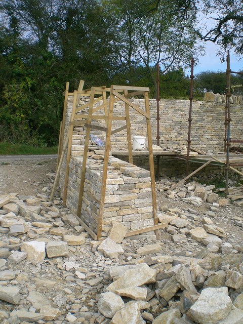
Image: © Stefan Czapski Taken: 15 Oct 2009
A minor road known as Sandy Lane leaves Corfe Castle just north of the railway bridge. It climbs quite steeply then runs ESE towards Swanage, quite high up on the southern flank of the ridge. Approaching Woolgarston on this road I spotted this wall under construction. For a few years of my life I made musical instruments, so was fascinated to see the methods which men who work in stone use to control their materials. Building a wall like this must be fantastically satisfying - what a way to leave your mark on the countryside ! This is the first of a sequence of five items. For the next, see Image
Images are licensed for reuse under creativecommons.org/licenses/by-sa/2.0
Image Location

Latitude
50.632834
Longitude
-2.023702