Little Norman Street Farmhouse Ide Hill, Kent
Introduction
The photograph on this page of Little Norman Street Farmhouse Ide Hill, Kent by Jean Barrow as part of the Geograph project.
The Geograph project started in 2005 with the aim of publishing, organising and preserving representative images for every square kilometre of Great Britain, Ireland and the Isle of Man.

There are currently over 7.5m images from over 14,400 individuals and you can help contribute to the project by visiting https://www.geograph.org.uk
Little Norman Street Farmhouse Ide Hill, Kent
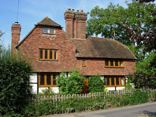
Image: © Jean Barrow Taken: 5 Aug 2006
The farm buildings of this small farm have now been converted into housing. Little Norman Street is fortunate in having deeds which show that it has been an independent small-holding of under ten acres for at least three hundred years. Until 1900 it was described as "Brook, near Brook Place".
Images are licensed for reuse under creativecommons.org/licenses/by-sa/2.0
Image Location


Leaflet Map data © OpenStreetMap
Latitude
51.255008
Longitude
0.12808