Martin Way Methodist Church
Introduction
The photograph on this page of Martin Way Methodist Church by Derek Harper as part of the Geograph project.
The Geograph project started in 2005 with the aim of publishing, organising and preserving representative images for every square kilometre of Great Britain, Ireland and the Isle of Man.

There are currently over 7.5m images from over 14,400 individuals and you can help contribute to the project by visiting https://www.geograph.org.uk
Martin Way Methodist Church
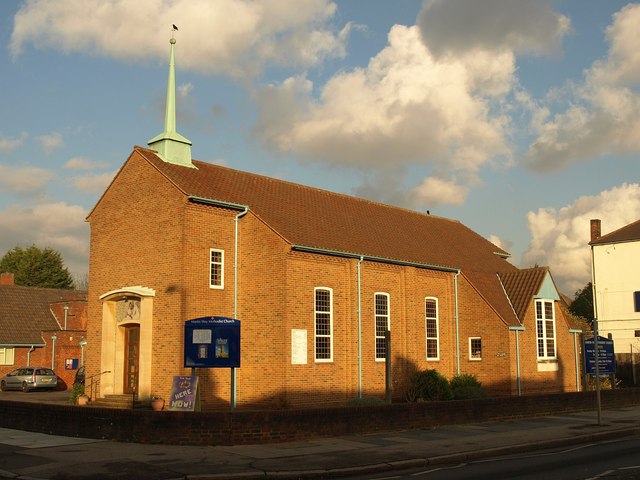
Image: © Derek Harper Taken: 16 Nov 2010
Glowing in afternoon sun, the church is beside the junction with Buckleigh Avenue. The church was built in 1957-8 http://www.martinway.org.uk/mw1frame/history.htm .
Images are licensed for reuse under creativecommons.org/licenses/by-sa/2.0
Image Location
Latitude
51.402821
Longitude
-0.208687