Glebelands Pond
Introduction
The photograph on this page of Glebelands Pond by Martin Addison as part of the Geograph project.
The Geograph project started in 2005 with the aim of publishing, organising and preserving representative images for every square kilometre of Great Britain, Ireland and the Isle of Man.

There are currently over 7.5m images from over 14,400 individuals and you can help contribute to the project by visiting https://www.geograph.org.uk
Glebelands Pond
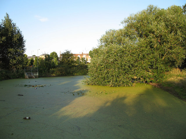
Image: © Martin Addison Taken: 10 Aug 2006
Man-made pond at the western end of the Glebelands Local Nature Reserve. A Weeping Willow dips its leaves in the waters edge. A resident family of Moorhen's have left trails through the duck weed that conceals the surface. There are waterlillies, which have finished flowering for this year and, unfortunately, plastic bottles. In the distance is a parade of shops on Glebe Road.
Images are licensed for reuse under creativecommons.org/licenses/by-sa/2.0
Image Location
Latitude
51.603145
Longitude
-0.171933