Cenotaph shadow, Hooton, Cheshire
Introduction
The photograph on this page of Cenotaph shadow, Hooton, Cheshire by Liz Taylor as part of the Geograph project.
The Geograph project started in 2005 with the aim of publishing, organising and preserving representative images for every square kilometre of Great Britain, Ireland and the Isle of Man.

There are currently over 7.5m images from over 14,400 individuals and you can help contribute to the project by visiting https://www.geograph.org.uk
Cenotaph shadow, Hooton, Cheshire
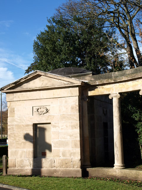
Image: © Liz Taylor Taken: 15 Nov 2010
The view is of the left-hand former lodge, with Ionic columns, one of a pair of lodges and symmetrical columns, erected in 1778, which were the former Chester-gate entrance [A41 trunk road] to Hooton Park and the now-demolished Hooton Hall. The entrance is sadly spoiled by a pair of white-painted bollards [which I managed to mask by columns in my series of photos] and leads within metres to the Victorian St. Paul's Church and late 20thC church hall, then onward to a golf course.
Images are licensed for reuse under creativecommons.org/licenses/by-sa/2.0
Image Location
Latitude
53.29066
Longitude
-2.951657