Hertford: The Gulphs
Introduction
The photograph on this page of Hertford: The Gulphs by Nigel Cox as part of the Geograph project.
The Geograph project started in 2005 with the aim of publishing, organising and preserving representative images for every square kilometre of Great Britain, Ireland and the Isle of Man.

There are currently over 7.5m images from over 14,400 individuals and you can help contribute to the project by visiting https://www.geograph.org.uk
Hertford: The Gulphs
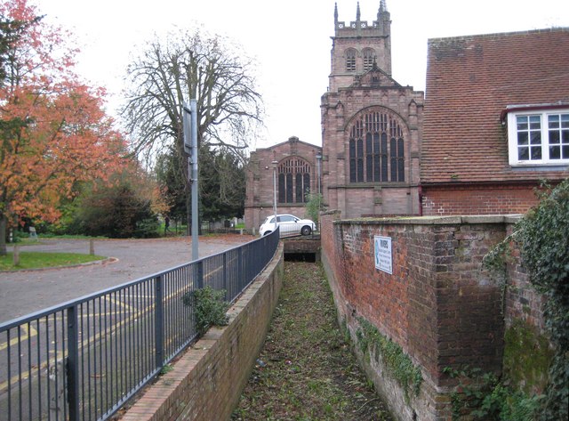
Image: © Nigel Cox Taken: 29 Oct 2010
The Gulphs is the name of an intermittently flowing stream, also known as the Ashbourne, and colloquially as The Quicks, that flows from the hilly ground south of Hertford to eventually discharge into the River Lee. It is now either culverted or otherwise hidden away out of sight for much of its length through Hertford. Here, at the end of October 2010, it was totally dry in this reach with All Saints' Church in the background.
Images are licensed for reuse under creativecommons.org/licenses/by-sa/2.0
Image Location
Latitude
51.795292
Longitude
-0.075131