Sandal Castle (20)
Introduction
The photograph on this page of Sandal Castle (20) by Mike Kirby as part of the Geograph project.
The Geograph project started in 2005 with the aim of publishing, organising and preserving representative images for every square kilometre of Great Britain, Ireland and the Isle of Man.

There are currently over 7.5m images from over 14,400 individuals and you can help contribute to the project by visiting https://www.geograph.org.uk
Sandal Castle (20)
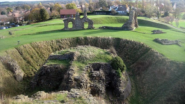
Image: © Mike Kirby Taken: 10 Nov 2010
Viewed from the top of the mound looking across to the visitor centre. (Note the inner and outer moats).
Images are licensed for reuse under creativecommons.org/licenses/by-sa/2.0
Image Location
Latitude
53.658413
Longitude
-1.490026