Boarstall Tower and the moat
Introduction
The photograph on this page of Boarstall Tower and the moat by Rob Dixon as part of the Geograph project.
The Geograph project started in 2005 with the aim of publishing, organising and preserving representative images for every square kilometre of Great Britain, Ireland and the Isle of Man.

There are currently over 7.5m images from over 14,400 individuals and you can help contribute to the project by visiting https://www.geograph.org.uk
Boarstall Tower and the moat
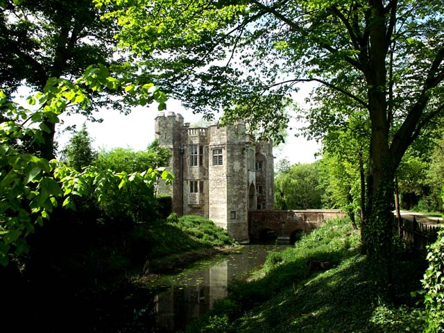
Image: © Rob Dixon Taken: 7 May 2003
On 12th September 1312, King Edward II granted John de Haudlo a licence to fortify his mansion house at Boarstall with a wall of lime and stone. The magnificent fortified gatehouse seen in the photograph above and known for some time as Boarstall Tower is the result. This may seem a somewhat free interpretation of the licence quod ipse mansum suum de Borstall [sic] juxta Brehull [Brill] in Com. Buck. muro de petra & calce firmare & kernellare possit but all licences "to crenellate" were similarly worded.
Images are licensed for reuse under creativecommons.org/licenses/by-sa/2.0
Image Location
Latitude
51.823126
Longitude
-1.095889