Manchester, Bolton & Bury Canal; Site of the 1936 Breach
Introduction
The photograph on this page of Manchester, Bolton & Bury Canal; Site of the 1936 Breach by David Dixon as part of the Geograph project.
The Geograph project started in 2005 with the aim of publishing, organising and preserving representative images for every square kilometre of Great Britain, Ireland and the Isle of Man.

There are currently over 7.5m images from over 14,400 individuals and you can help contribute to the project by visiting https://www.geograph.org.uk
Manchester, Bolton & Bury Canal; Site of the 1936 Breach
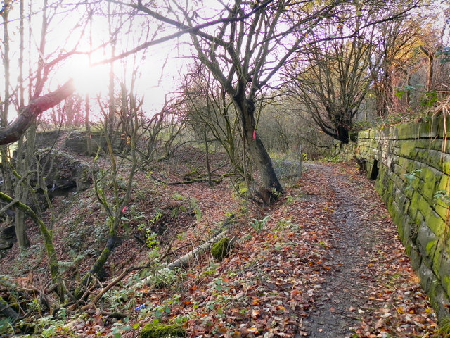
Image: © David Dixon Taken: 14 Nov 2010
Looking west, past the site of the breach. The path here is following the canal bed. To the left, the towpath and embankment were swept away in 1936. On the right hand side, the massive canal wall is still clearly evident.
Images are licensed for reuse under creativecommons.org/licenses/by-sa/2.0
Image Location
Latitude
53.55514
Longitude
-2.371896