'The Railway' inn, Buntingford, Herts.
Introduction
The photograph on this page of 'The Railway' inn, Buntingford, Herts. by Robert Edwards as part of the Geograph project.
The Geograph project started in 2005 with the aim of publishing, organising and preserving representative images for every square kilometre of Great Britain, Ireland and the Isle of Man.

There are currently over 7.5m images from over 14,400 individuals and you can help contribute to the project by visiting https://www.geograph.org.uk
'The Railway' inn, Buntingford, Herts.
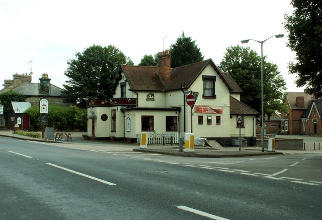
Image: © Robert Edwards Taken: 4 Aug 2006
The main road in the picture is the old A.10, which is part of the Roman road, Ermine Street. The side road on the right leads to Aspenden.
Images are licensed for reuse under creativecommons.org/licenses/by-sa/2.0
Image Location
Latitude
51.94099
Longitude
-0.017106