Southampton Western Docks
Introduction
The photograph on this page of Southampton Western Docks by Chris Allen as part of the Geograph project.
The Geograph project started in 2005 with the aim of publishing, organising and preserving representative images for every square kilometre of Great Britain, Ireland and the Isle of Man.

There are currently over 7.5m images from over 14,400 individuals and you can help contribute to the project by visiting https://www.geograph.org.uk
Southampton Western Docks
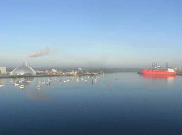
Image: © Chris Allen Taken: 23 May 2009
The photographer position is a bit of a guess; taken from a cruise ship coming into the Mayflower Terminal in the early morning. Marchwood incinerator is on the left and the big red ship is the laid up LNG carrier SS Margaret Hill (a real steam ship, no less).
Images are licensed for reuse under creativecommons.org/licenses/by-sa/2.0
Image Location


Leaflet Map data © OpenStreetMap
Latitude
50.902922
Longitude
-1.446461