View across Chesterfield
Introduction
The photograph on this page of View across Chesterfield by Andrew Hill as part of the Geograph project.
The Geograph project started in 2005 with the aim of publishing, organising and preserving representative images for every square kilometre of Great Britain, Ireland and the Isle of Man.

There are currently over 7.5m images from over 14,400 individuals and you can help contribute to the project by visiting https://www.geograph.org.uk
View across Chesterfield
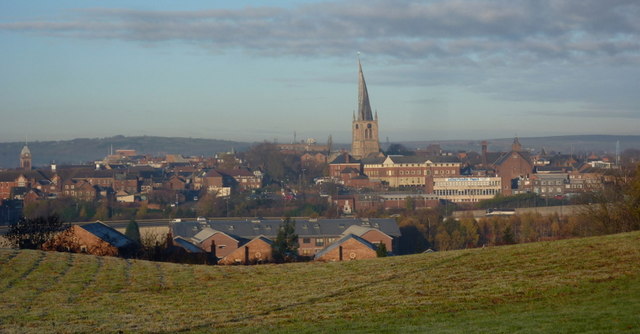
Image: © Andrew Hill Taken: 16 Nov 2010
A view from Hady Hill, the A632 east of the town, looking right across Chesterfield with the famous crooked spire of the church being the most prominent feature.
Images are licensed for reuse under creativecommons.org/licenses/by-sa/2.0
Image Location
Latitude
53.23572
Longitude
-1.423895