The Muckle Stane
Introduction
The photograph on this page of The Muckle Stane by Mary and Angus Hogg as part of the Geograph project.
The Geograph project started in 2005 with the aim of publishing, organising and preserving representative images for every square kilometre of Great Britain, Ireland and the Isle of Man.

There are currently over 7.5m images from over 14,400 individuals and you can help contribute to the project by visiting https://www.geograph.org.uk
The Muckle Stane
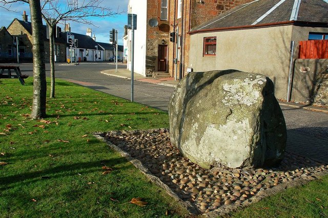
Image: © Mary and Angus Hogg Taken: 10 Nov 2010
The information plaque reads: MONKTON HISTORICAL SOCIETY THE MUCKLE STANE (ERRATIC BOULDER) ARRIVED AT END OF ICE AGE TO MAP REF. 285360 PLACED HERE ON 29th SEPT. 1998 PLAQUE DONATED BY SOUTH AYRSHIRE COUNCIL
Images are licensed for reuse under creativecommons.org/licenses/by-sa/2.0
Image Location
Latitude
55.516002
Longitude
-4.601848