Benchmark on Station Road West, Penmaenmawr
Introduction
The photograph on this page of Benchmark on Station Road West, Penmaenmawr by Meirion as part of the Geograph project.
The Geograph project started in 2005 with the aim of publishing, organising and preserving representative images for every square kilometre of Great Britain, Ireland and the Isle of Man.

There are currently over 7.5m images from over 14,400 individuals and you can help contribute to the project by visiting https://www.geograph.org.uk
Benchmark on Station Road West, Penmaenmawr
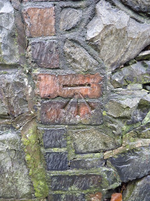
Image: © Meirion Taken: 8 Nov 2010
This benchmark is located on the NW side of Station Road West in Penmaenmawr & it is shown in the current Ordnance Survey database at a height of 10.3845m above the Newlyn datum.
Images are licensed for reuse under creativecommons.org/licenses/by-sa/2.0
Image Location
Latitude
53.270211
Longitude
-3.924114