Rosehill
Introduction
The photograph on this page of Rosehill by Anne Burgess as part of the Geograph project.
The Geograph project started in 2005 with the aim of publishing, organising and preserving representative images for every square kilometre of Great Britain, Ireland and the Isle of Man.

There are currently over 7.5m images from over 14,400 individuals and you can help contribute to the project by visiting https://www.geograph.org.uk
Rosehill
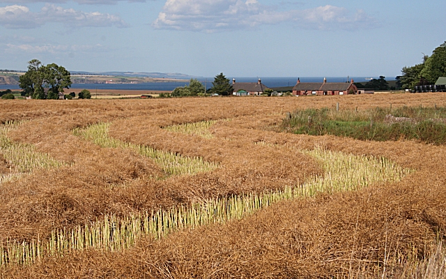
Image: © Anne Burgess Taken: 30 Jul 2006
Cottages at Rosehill Farm lie beyond a harvested oilseed rape field. In the distance is Lunan Bay, and beyond it the east coast as far as Johnshaven and Gourdon.
Images are licensed for reuse under creativecommons.org/licenses/by-sa/2.0
Image Location
Latitude
56.612803
Longitude
-2.539253