Kimberley from the cemetery
Introduction
The photograph on this page of Kimberley from the cemetery by Lynne Kirton as part of the Geograph project.
The Geograph project started in 2005 with the aim of publishing, organising and preserving representative images for every square kilometre of Great Britain, Ireland and the Isle of Man.

There are currently over 7.5m images from over 14,400 individuals and you can help contribute to the project by visiting https://www.geograph.org.uk
Kimberley from the cemetery
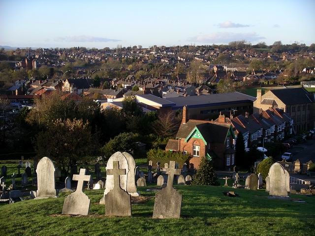
Image: © Lynne Kirton Taken: 13 Nov 2010
Being on top of a hill in the middle of Kimberley, the cemetery commands a wide-ranging view across the town and beyond. The large, grey-roofed building in the centre of this picture is Sainsbury's, which dominates the town. Sainsbury's is built on the site of the old Wolsey factory. The road leading to Sainsbury's used to be called Factory Lane. However, the name was changed to Greens Lane when the supermarket and adjacent shopping precinct were completed, presumably because the old name no longer reflected the newly renovated area.
Images are licensed for reuse under creativecommons.org/licenses/by-sa/2.0
Image Location
Latitude
52.996207
Longitude
-1.254403