St Ann's Church, Battlefield
Introduction
The photograph on this page of St Ann's Church, Battlefield by Andrew Curtis as part of the Geograph project.
The Geograph project started in 2005 with the aim of publishing, organising and preserving representative images for every square kilometre of Great Britain, Ireland and the Isle of Man.

There are currently over 7.5m images from over 14,400 individuals and you can help contribute to the project by visiting https://www.geograph.org.uk
St Ann's Church, Battlefield
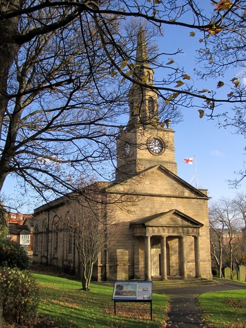
Image: © Andrew Curtis Taken: 11 Nov 2010
The church was built in 1764-68, to designs by William Newton, on the site of a medieval chapel. The building stone used was taken from the City Walls which used to run alongside the Quayside. The church was surrounded by open fields and was a prominent feature of the Quayside until terraced housing was built after 1880. The area became known as Battlefields from its popularity as a venue for dog fights. The church was a very important part of the local community. Tyne and Wear HER (9150): Byker, City Road, Church of St. Ann http://www.twsitelines.info
Images are licensed for reuse under creativecommons.org/licenses/by-sa/2.0
Image Location


Leaflet Map data © OpenStreetMap
Latitude
54.972371
Longitude
-1.594591