
Llwybr Landsker / Landsker Trail
Introduction
The photograph on this page of Llwybr Landsker / Landsker Trail by Alan Richards as part of the Geograph project.
The Geograph project started in 2005 with the aim of publishing, organising and preserving representative images for every square kilometre of Great Britain, Ireland and the Isle of Man.

There are currently over 7.5m images from over 14,400 individuals and you can help contribute to the project by visiting https://www.geograph.org.uk
Llwybr Landsker / Landsker Trail
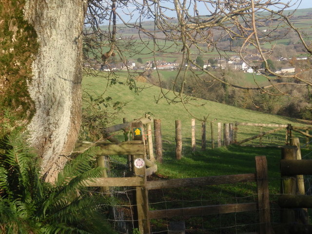
Image: © Alan Richards Taken: 10 Nov 2010
Mae Landsker yn enw Llychlyneg i ddynodi ffin. Yng nghyswllt Sir Benfro mae'r Landsker yn ffin anweledig sy'n gwahanu'r Cymry Cymraeg gogleddol y sir a'r Cymry di-Gymraeg a drig i'r de o'r ffin. Felly cafwyd y syniad o greu cylchdaith 60 milltir o hyd a a heibio i'r cymunedau hynny a saif ar y ffin ieithyddol hon neu ar naill ochr iddi. Y pentref yn y pellter yw Llanboidy a saif ar ochr Cymraeg o'r ffin. Landsker is a Norse word which means borderland. In the context of Pembrokeshire the Landsker is an invisible boundary line which separates the Welsh speaking population living in the north of the county from the English speakers to the south. Therefore, the 60 mile circular Landsker Trail visits those communities which are located on or are very near to this linguistic boundary. The village in the distance is Llanboidy which is located on the Welsh speaking side of this borderline.
Images are licensed for reuse under creativecommons.org/licenses/by-sa/2.0
Image Location

Latitude
51.8752
Longitude
-4.607392