Station Road bridge
Introduction
The photograph on this page of Station Road bridge by Graham Horn as part of the Geograph project.
The Geograph project started in 2005 with the aim of publishing, organising and preserving representative images for every square kilometre of Great Britain, Ireland and the Isle of Man.

There are currently over 7.5m images from over 14,400 individuals and you can help contribute to the project by visiting https://www.geograph.org.uk
Station Road bridge
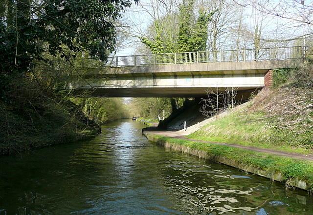
Image: © Graham Horn Taken: 10 Apr 2010
This bridge carries Station Road, the link from Tring, two miles to the left, to its railway station, 400 yards to the right. It also marks the start of the deepest part of Tring cutting, the summit of the Grand Union canal on its route across the Chiltern hills.
Images are licensed for reuse under creativecommons.org/licenses/by-sa/2.0
Image Location
Latitude
51.799426
Longitude
-0.626207