Sandy Lane junction, Hatford
Introduction
The photograph on this page of Sandy Lane junction, Hatford by Brian Robert Marshall as part of the Geograph project.
The Geograph project started in 2005 with the aim of publishing, organising and preserving representative images for every square kilometre of Great Britain, Ireland and the Isle of Man.

There are currently over 7.5m images from over 14,400 individuals and you can help contribute to the project by visiting https://www.geograph.org.uk
Sandy Lane junction, Hatford
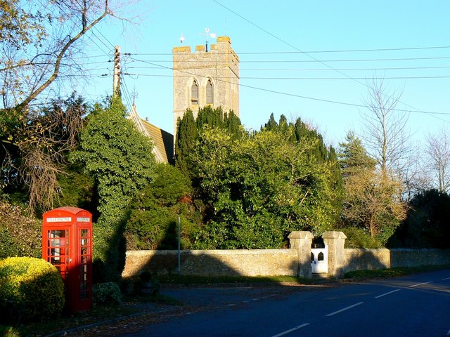
Image: © Brian Robert Marshall Taken: 10 Nov 2010
The imposing-looking church in the background has been converted to a dwelling, Church House. If it is listed I've been unable to find details so I suspect it is possibly Victorian. It was sold for conversion in 1972. Hatford is pretty but otherwise unremarkable. It has few amenities having lost its off-licence to a German bomb in 1940. Sandy Lane leads off the main road to the left to join the A420 a few kilometres to the north-west.
Images are licensed for reuse under creativecommons.org/licenses/by-sa/2.0
Image Location
Latitude
51.651159
Longitude
-1.511983