City Boundary 1904 stone, Bristol
Introduction
The photograph on this page of City Boundary 1904 stone, Bristol by Jaggery as part of the Geograph project.
The Geograph project started in 2005 with the aim of publishing, organising and preserving representative images for every square kilometre of Great Britain, Ireland and the Isle of Man.

There are currently over 7.5m images from over 14,400 individuals and you can help contribute to the project by visiting https://www.geograph.org.uk
City Boundary 1904 stone, Bristol
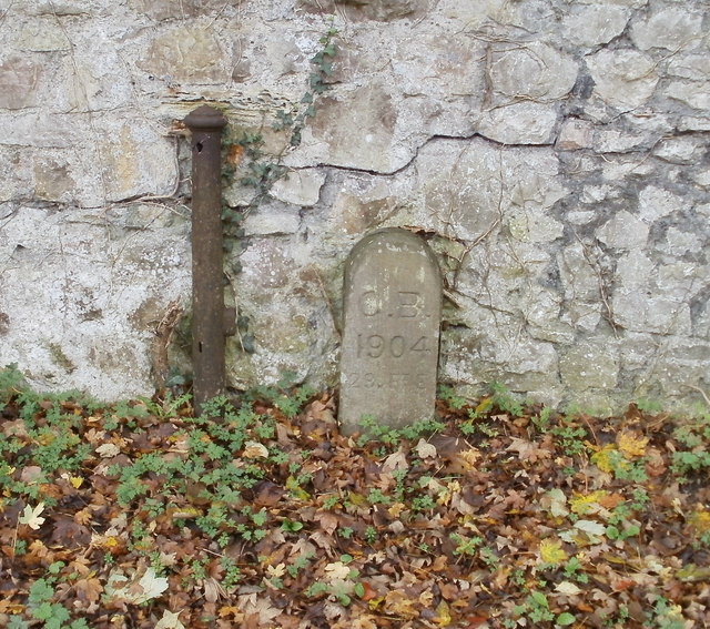
Image: © Jaggery Taken: 6 Nov 2010
In 1904, Shirehampton, Westbury on Trym and part of Henbury, all formerly in south Gloucestershire, became part of the City and County of Bristol. To mark the new city boundary in these places, stones with C.B. 1904 incised on them were installed. This one is on the west side of Passage Road, near to the turning for Westacre Close.
Images are licensed for reuse under creativecommons.org/licenses/by-sa/2.0
Image Location
Latitude
51.503818
Longitude
-2.615148