The Length of Noel Street - 2
Introduction
The photograph on this page of The Length of Noel Street - 2 by John Sutton as part of the Geograph project.
The Geograph project started in 2005 with the aim of publishing, organising and preserving representative images for every square kilometre of Great Britain, Ireland and the Isle of Man.

There are currently over 7.5m images from over 14,400 individuals and you can help contribute to the project by visiting https://www.geograph.org.uk
The Length of Noel Street - 2
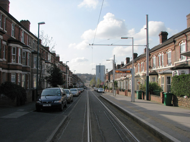
Image: © John Sutton Taken: 16 Apr 2010
This view south from Beaconsfield Street tram stop shows almost all of Noel Street, with Gregory Boulevard at the bottom of the hill and the climb past The Forest tram stop to Mount Hooton Road in the centre distance, to the left of Hyson Green's only high-rise block. The houses on Noel Street were built in the 1880s. Image] is the northbound view, from the corner of Bentinck Road.
Images are licensed for reuse under creativecommons.org/licenses/by-sa/2.0
Image Location
Latitude
52.968679
Longitude
-1.169855