Bangor Town Hall
Introduction
The photograph on this page of Bangor Town Hall by Albert Bridge as part of the Geograph project.
The Geograph project started in 2005 with the aim of publishing, organising and preserving representative images for every square kilometre of Great Britain, Ireland and the Isle of Man.

There are currently over 7.5m images from over 14,400 individuals and you can help contribute to the project by visiting https://www.geograph.org.uk
Bangor Town Hall
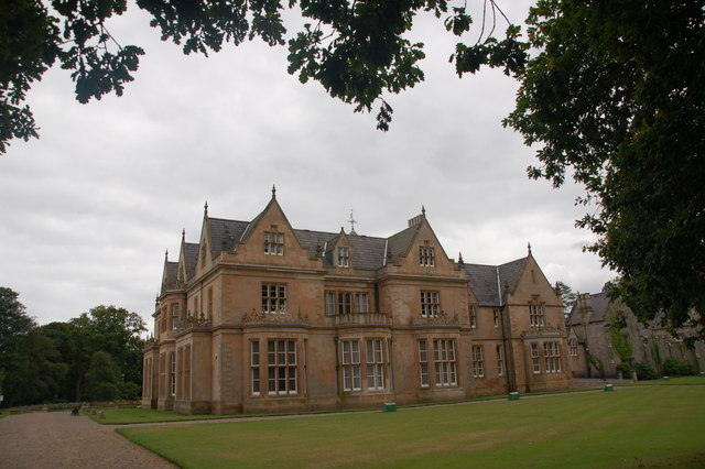
Image: © Albert Bridge Taken: 5 Aug 2006
Bangor Town Hall was built as Bangor Castle in 1852 for Robert Ward. It was acquired by the Council in 1941 and became the Town Hall in 1952. It has an attractive setting in Castle Park (the former grounds). As well as the council chamber and offices it also contains a heritage centre.
Images are licensed for reuse under creativecommons.org/licenses/by-sa/2.0
Image Location


Leaflet Map data © OpenStreetMap
Latitude
54.659147
Longitude
-5.668568