Shelvin Grove
Introduction
The photograph on this page of Shelvin Grove by David Anstiss as part of the Geograph project.
The Geograph project started in 2005 with the aim of publishing, organising and preserving representative images for every square kilometre of Great Britain, Ireland and the Isle of Man.

There are currently over 7.5m images from over 14,400 individuals and you can help contribute to the project by visiting https://www.geograph.org.uk
Shelvin Grove
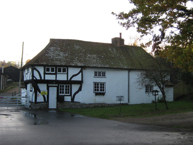
Image: © David Anstiss Taken: 31 Oct 2010
Grade II Listed Farmhouse in Park Farm. Farm is now a joinery business. Called Dover Trussed Roof Company. See http://www.dovertruss.co.uk/index1.htm for more details. The farmhouse is used as a reception room for visitors to the company. See http://www.britishlistedbuildings.co.uk/en-178584-shelvin-grove-denton-with-wootton for more details of the listed building
Images are licensed for reuse under creativecommons.org/licenses/by-sa/2.0
Image Location


Leaflet Map data © OpenStreetMap
Latitude
51.181033
Longitude
1.180307