Alexandra Palace Station
Introduction
The photograph on this page of Alexandra Palace Station by Martin Addison as part of the Geograph project.
The Geograph project started in 2005 with the aim of publishing, organising and preserving representative images for every square kilometre of Great Britain, Ireland and the Isle of Man.

There are currently over 7.5m images from over 14,400 individuals and you can help contribute to the project by visiting https://www.geograph.org.uk
Alexandra Palace Station
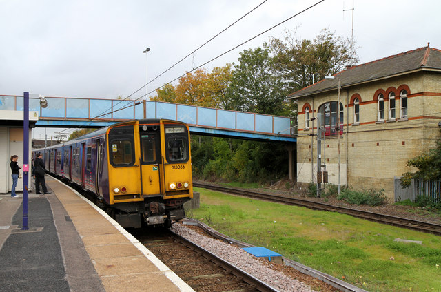
Image: © Martin Addison Taken: 28 Oct 2010
A Moorgate bound class 313 electric unit stops to collect passengers. On the right is the station building which stands on Buckingham Road. The large glazed window in the side is almost certainly the location of the original footbridge accessing the platforms. This would have been removed at the time that the line was electrified, sometime between 1973 and 1978 when the electrification was completed. The modern footbridge and station buildings on the platforms date to that time. The line on the right is the headshunt for Bounds Green Depot, which is located on the opposite side of the bridge carrying Buckingham Road over the railway - just visible above the train.
Images are licensed for reuse under creativecommons.org/licenses/by-sa/2.0
Image Location
Latitude
51.598271
Longitude
-0.119571